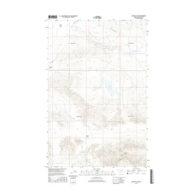
2017 Map of Buckley Lake
USGS Topo · Published 2017About this map
Sun Prairie Flats dominates the northern landscape of this Phillips County territory, where high plains topography meets the intricate drainage systems of the Missouri River watershed. The area is defined by its seasonal hydrology, centered on the namesake Buckley Lake and the intermittent flows of Sage Cr and Tallow Cr. To the south, the terrain becomes more complex as it rises into the Larb Hills, a rugged upland characterized by deep erosion and named high points such as Collins Hill. The sparse road network, consisting primarily of Content Rd and Triple Crossing Rd, reflects the expansive ranching and prairie character of this part of Montana. For researchers of Big Sky Country history, the map provides a clear view of land management through township and range boundaries, including t26n r32e and t26n r33e, alongside distinctive geological formations like Badland Coulee and Plummer Coulee.
Find a feature on this map
17 named features on this map. Tap any name to fly to it.
Don’t see what you’re looking for? This feature index may not catch every label — zoom into the map to look around manually.
Map Details
Editions of this 2017 Buckley Lake Map
This is the sole edition of this map. No revisions or reprints were ever made.
Other maps of this area

1954 · Jordan
USGS Topo · 1:250,000

1954 · Glasgow
USGS Topo · 1:250,000

1956 · Jordan
USGS Topo · 1:250,000

1957 · Glasgow
USGS Topo · 1:250,000

1958 · Glasgow
USGS Topo · 1:250,000

1958 · Jordan
USGS Topo · 1:250,000

1964 · Jordan
USGS Topo · 1:250,000

1965 · Coal Mine Hill
USGS Topo · 1:24,000

1965 · Sun Prairie
USGS Topo · 1:24,000

1965 · Buckley Lake
USGS Topo · 1:24,000