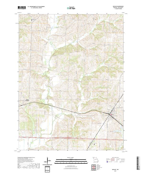
2021 Map of Bucklin
USGS Topo · Published 2021About this map
Bucklin and Saint Catharine anchor this survey of Linn County, Missouri, where the landscape is defined by the branching tributaries of the Grand River system. The drainage patterns of E Yellow Cr, Onion Br, and Sights Br carve a rolling topography that dictates the grid of rural routes such as Ludlow Rd and Mesa Rd. Genealogical interest is found at the Pleasant View Baptist Cem in the northwest and Cash Cem to the southeast, marking long-standing community centers. The layout of Bucklin shows a concentrated town site near Bucklin Reservoir, with a street plan including Santa Fe Ave and Nettleton St that reflects its historical development as a local hub. The presence of numerous named creek branches like Van Dorsen Cr and Clocks Cr illustrates the well-watered nature of this agricultural region.
Find a feature on this map
49 named features on this map. Tap any name to fly to it.
Don’t see what you’re looking for? This feature index may not catch every label — zoom into the map to look around manually.
Map Details
Editions of this 2021 Bucklin Map
This is the sole edition of this map. No revisions or reprints were ever made.
Other maps of this area

1946 · Brookfield
USGS Topo · 1:62,500

1948 · Brookfield
USGS Topo · 1:62,500

1949 · Rothville
USGS Topo · 1:24,000

1949 · Bucklin
USGS Topo · 1:24,000

1949 · Bucklin NW
USGS Topo · 1:24,000

1950 · Bucklin
USGS Topo · 1:24,000

1950 · New Cambria West
USGS Topo · 1:24,000

1950 · Rothville
USGS Topo · 1:24,000

1950 · Bucklin NW
USGS Topo · 1:24,000

1951 · New Boston
USGS Topo · 1:24,000