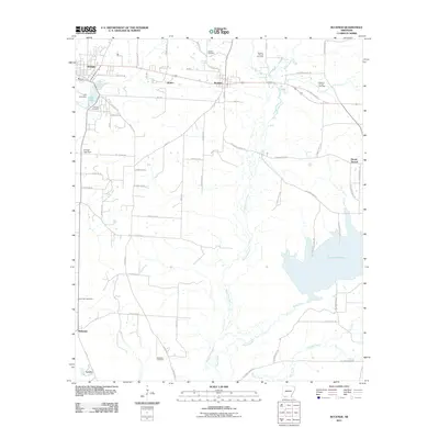
2011 Map of Buckner
USGS Topo · Published 2011About this map
Stamps and Buckner anchor this Lafayette County landscape, where the local economy is defined by the extensive Buckner Oil and Gas Field. The terrain is deeply influenced by the winding path of Bayou Dorcheat and its tributaries, including Clear Creek and Beech Creek, which carve through the region. Significant water features like Lake June and the expansive Lake Columbia provide clear landmarks for the area's geography. Smaller settlements such as Apalco, McKamie, and Lerch are connected by a network of county roads, while multiple burial sites, including Buckner Cemetery and Patterson Cemetery, offer critical points of interest for genealogical research into the local families of this southwestern Arkansas region.
Find a feature on this map
73 named features on this map. Tap any name to fly to it.
Don’t see what you’re looking for? This feature index may not catch every label — zoom into the map to look around manually.
Map Details
Editions of this 2011 Buckner Map
This is the sole edition of this map. No revisions or reprints were ever made.
Other maps of this area

1952 · Bradley NE
USGS Topo · 1:24,000

1952 · Old Town
USGS Topo · 1:24,000

1952 · Lewisville
USGS Topo · 1:24,000

1953 · El Dorado
USGS Topo · 1:250,000

1957 · El Dorado
USGS Topo · 1:250,000

1958 · El Dorado
USGS Topo · 1:250,000

1960 · El Dorado
USGS Topo · 1:250,000

1960 · Bussey
USGS Topo · 1:24,000

1960 · Macedonia
USGS Topo · 1:24,000

1968 · Buckner
USGS Topo · 1:24,000