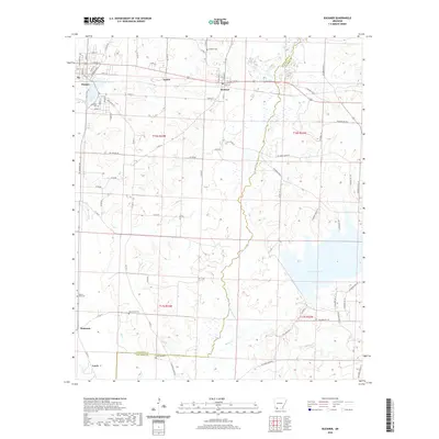
2020 Map of Buckner
USGS Topo · Published 2020About this map
Stamps and Buckner anchor the northern reaches of this landscape, where the local street grids of Stamps reflect a well-established community organized around Lake June. To the east, the sprawling waters of Lake Columbia dominate the terrain, creating a significant hydrological feature at the intersection of Lafayette and Columbia counties. The map captures a detailed network of rural routes and named county roads that connect smaller settlements like Apalco, McKamie, and Lerch.
Find a feature on this map
84 named features on this map. Tap any name to fly to it.
Don’t see what you’re looking for? This feature index may not catch every label — zoom into the map to look around manually.
Map Details
Editions of this 2020 Buckner Map
This is the sole edition of this map. No revisions or reprints were ever made.
Other maps of this area

1952 · Bradley NE
USGS Topo · 1:24,000

1952 · Old Town
USGS Topo · 1:24,000

1952 · Lewisville
USGS Topo · 1:24,000

1953 · El Dorado
USGS Topo · 1:250,000

1957 · El Dorado
USGS Topo · 1:250,000

1958 · El Dorado
USGS Topo · 1:250,000

1960 · El Dorado
USGS Topo · 1:250,000

1960 · Bussey
USGS Topo · 1:24,000

1960 · Macedonia
USGS Topo · 1:24,000

1968 · Buckner
USGS Topo · 1:24,000