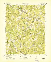
1943 Map of Buckner
USGS Topo · Published 1943About this map
The Chesapeake and Ohio railroad corridor anchors the rural landscape of eastern Louisa County, connecting established rail-stops and family-named crossroads during the early 1940s. Centered on the town of Buckner and the nearby Fredericks Hall, the map reveals a network of country commerce and community life. Local gathering points such as Brooks Store and Harts Shop sit alongside numerous houses of worship, including Little River Church and Watch Tower Church.
Find a feature on this map
28 named features on this map. Tap any name to fly to it.
Don’t see what you’re looking for? This feature index may not catch every label — zoom into the map to look around manually.
Map Details
Editions of this 1943 Buckner Map
This is the sole edition of this map. No revisions or reprints were ever made.
Other maps of this area

1887 · Spottsylvania
USGS Topo · 1:125,000

1890 · Goochland
USGS Topo · 1:125,000

1892 · Spottsylvania
USGS Topo · 1:125,000

1892 · Goochland
USGS Topo · 1:125,000

1942 · Mineral
USGS Topo · 1:31,680

1942 · Partlow
USGS Topo · 1:31,680

1942 · Contrary Creek
USGS Topo · 1:31,680

1942 · Pendleton
USGS Topo · 1:24,000

1942 · Buckner
USGS Topo · 1:24,000

1942 · Beaverdam
USGS Topo · 1:24,000