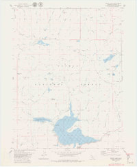
1979 Map of Bucks Lake
USGS Topo · Published 1979About this map
The high Sierra Nevada landscape of Plumas National Forest is defined here by the extensive reservoir system and recreation infrastructure of the late 1970s. Bucks Lake and Lower Bucks Lake dominate the southern portion of the sheet, supported by a Gaging Station, Boat Ramp, and the Mormon Trail Camp. This area served as a significant alpine retreat, with the Bucks Lodge providing a hub for visitors near the Quincy Oroville Road.
Find a feature on this map
62 named features on this map. Tap any name to fly to it.
Don’t see what you’re looking for? This feature index may not catch every label — zoom into the map to look around manually.
Map Details
Editions of this 1979 Bucks Lake Map
2 editions found
Other maps of this area

1886 · Lassen Peak
USGS Topo · 1:250,000

1888 · Bidwell Bar
USGS Topo · 1:125,000

1891 · Bidwell Bar
USGS Topo · 1:125,000

1892 · Lassen Peak
USGS Topo · 1:250,000

1893 · Bidwell Bar
USGS Topo · 1:125,000

1894 · Lassen Peak
USGS Topo · 1:250,000

1895 · Bidwell Bar
USGS Topo · 1:125,000

1897 · Bidwell Bar
USGS Topo · 1:125,000

1950 · Bucks Lake
USGS Topo · 1:62,500

1955 · Almanor
USGS Topo · 1:62,500