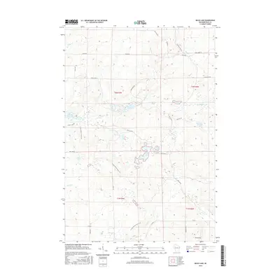
2015 Map of Bucks Lake
USGS Topo · Published 2015About this map
The Ice Age National Scenic Trail winds through this heavily forested portion of Rusk County, tracing the glacial topography that defines the region's hydrography. Water is the primary feature here, with Bucks Lake and the significant Murphy Flowage anchoring a network of small lakes and streams. The terrain rises toward Mt Atlanta in the southeast, while numerous watercourses like Big Weirgor Cr and Hemlock Cr drain the glacial till. The landscape is interconnected by a series of backroads and trails, including Blue Hills Trail Rd and Serley Camp Trl, reflecting the area's use for timber and recreation. Local landmarks such as Audie Lake, Perch Lake, and Three Lakes suggest a transition into more concentrated lake clusters, providing a clear record of the northern Wisconsin wilderness as it appeared in the early 21st century.
Find a feature on this map
41 named features on this map. Tap any name to fly to it.
Don’t see what you’re looking for? This feature index may not catch every label — zoom into the map to look around manually.
Map Details
Editions of this 2015 Bucks Lake Map
This is the sole edition of this map. No revisions or reprints were ever made.
Other maps of this area

1945 · Meteor
USGS Topo · 1:48,000

1948 · Weyerhauser
USGS Topo · 1:48,000

1949 · Meteor
USGS Topo · 1:48,000

1949 · Rice Lake
USGS Topo · 1:48,000

1950 · Weyerhauser
USGS Topo · 1:48,000

1951 · Rice Lake
USGS Topo · 1:48,000

1951 · Chetek
USGS Topo · 1:62,500

1953 · Rice Lake
USGS Topo · 1:250,000

1959 · Rice Lake
USGS Topo · 1:250,000

1965 · Rice Lake
USGS Topo · 1:62,500