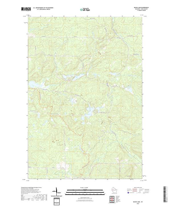
2022 Map of Bucks Lake
USGS Topo · Published 2022About this map
Mt Atlanta anchors the southern reaches of this landscape, overlooking a dense network of glacial water bodies and winding seasonal creeks in Rusk County. The prominent Ice Age National Scenic Trl meanders through the central terrain, tracing the geological history of the region between Pine Lake and the various branches of Hemlock Cr. The settlement pattern is defined by a remote grid of fire lanes and township roads, including Fire Lane Rd and Perch Lake Rd, which provide access to secluded water features like Lost Lake and the Hill Trail Flowage. This 2022 survey illustrates the modern conservation and recreation character of the northern woods, where drainage systems like Big Weirgor Cr and Spring Cr dominate the lowlands between timbered ridges.
Find a feature on this map
41 named features on this map. Tap any name to fly to it.
Don’t see what you’re looking for? This feature index may not catch every label — zoom into the map to look around manually.
Map Details
Editions of this 2022 Bucks Lake Map
This is the sole edition of this map. No revisions or reprints were ever made.
Other maps of this area

1945 · Meteor
USGS Topo · 1:48,000

1948 · Weyerhauser
USGS Topo · 1:48,000

1949 · Meteor
USGS Topo · 1:48,000

1949 · Rice Lake
USGS Topo · 1:48,000

1950 · Weyerhauser
USGS Topo · 1:48,000

1951 · Rice Lake
USGS Topo · 1:48,000

1951 · Chetek
USGS Topo · 1:62,500

1953 · Rice Lake
USGS Topo · 1:250,000

1959 · Rice Lake
USGS Topo · 1:250,000

1965 · Rice Lake
USGS Topo · 1:62,500