1985 Map of Bucktail
USGS Topo · Published 1986About this map
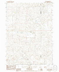
Sunnyside Ranch and other family-named cattle operations define this portion of the Nebraska Sandhills during the early 1980s. The landscape is characterized by a series of northwest-to-southeast trending depressions, including Center Valley and Sunnyside Valley, which provided sheltered locations for early ranching homesteads. The small settlement of Bucktail sits near the center of the sheet, adjacent to Bucktail Lake, serving as a focal point for this sparsely populated region. Tracing the section lines reveals the organized land division typical of the Great Plains, where isolated outposts like Sizer Ranch and Storer Ranch were established far from major population centers. The presence of Eaton Lake and the Sunnyside water feature highlights the critical importance of surface water and shallow groundwater in sustaining the region's agricultural economy.
Find a feature on this map
12 named features on this map. Tap any name to fly to it.
Don’t see what you’re looking for? This feature index may not catch every label — zoom into the map to look around manually.
Map Details
Editions of this 1985 Bucktail Map
This is the sole edition of this map. No revisions or reprints were ever made.
Other maps of this area

1897 · Ogallala
USGS Topo · 1:125,000

1898 · Paxton
USGS Topo · 1:125,000

1900 · Ogallala
USGS Topo · 1:125,000

1901 · Paxton
USGS Topo · 1:125,000

1949 · Arthur
USGS Topo · 1:62,500

1949 · Flats
USGS Topo · 1:62,500

1950 · Flats
USGS Topo · 1:62,500

1950 · Arthur
USGS Topo · 1:62,500

1954 · North Platte
USGS Topo · 1:250,000

1956 · North Platte
USGS Topo · 1:250,000