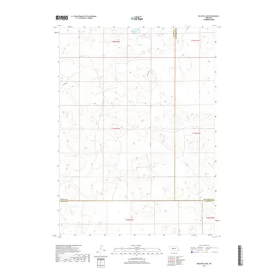
2017 Map of Bucktail Lake
USGS Topo · Published 2017About this map
Bucktail Lake sits at the heart of this Sandhills landscape, where the high plains of Nebraska meet a complex network of county boundaries. This 2017 survey documents the intersection of Arthur, McPherson, and Keith counties, a region defined by its wide-open topography and sparse infrastructure. The drainage of W Birdwood Cr flows through the southern reaches, providing a rare hydrological focal point in a territory otherwise dominated by section lines and local transit routes like Bucktail Rd and Packard Dr. The map reflects the enduring rural character of the Nebraska panhandle, where land use is strictly organized by the Public Land Survey System, as evidenced by the clearly marked townships including t17n r36w and t18n r36w.
Find a feature on this map
14 named features on this map. Tap any name to fly to it.
Don’t see what you’re looking for? This feature index may not catch every label — zoom into the map to look around manually.
Map Details
Editions of this 2017 Bucktail Lake Map
This is the sole edition of this map. No revisions or reprints were ever made.
Other maps of this area

1897 · Ogallala
USGS Topo · 1:125,000

1898 · Paxton
USGS Topo · 1:125,000

1900 · Ogallala
USGS Topo · 1:125,000

1901 · Paxton
USGS Topo · 1:125,000

1949 · Arthur
USGS Topo · 1:62,500

1949 · Flats
USGS Topo · 1:62,500

1950 · Flats
USGS Topo · 1:62,500

1950 · Arthur
USGS Topo · 1:62,500

1954 · North Platte
USGS Topo · 1:250,000

1956 · North Platte
USGS Topo · 1:250,000