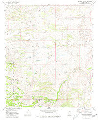
1981 Map of Buehman Canyon
USGS Topo · Published 1981About this map
Coronado National Forest lands dominate this topographical landscape, defined by a complex network of canyons and water sources used for ranching and resource management. Deep drainages like Alder Canyon and Buehman Canyon cut through the high elevations of Davis Mesa, where a system of isolated tanks and wells supported seasonal livestock operations. Local landmarks such as Brush Corrals and the Burleson Well indicate the area's pastoral utility, while a marked Prospect and several Pipeline corridors suggest ongoing interest in the region's mineral and energy potential. Springs like Cottonwood Cove Spring and Mesquite Flat Spring serve as critical hydrological points in this arid environment, often found near the steep walls of Edgar Canyon.
Find a feature on this map
39 named features on this map. Tap any name to fly to it.
Don’t see what you’re looking for? This feature index may not catch every label — zoom into the map to look around manually.
Map Details
Editions of this 1981 Buehman Canyon Map
2 editions found
Other maps of this area

1904 · Tucson
USGS Topo · 1:125,000

1905 · Tucson
USGS Topo · 1:125,000

1911 · Winkelman
USGS Topo · 1:125,000

1913 · Winkelman
USGS Topo · 1:125,000

1938 · Galiuro Mts
USGS Topo · 1:48,000

1943 · Galiuro Mts
USGS Topo · 1:62,500

1945 · Redington
USGS Topo · 1:62,500

1948 · Mammoth
USGS Topo · 1:62,500

1948 · Campo Bonito
USGS Topo · 1:24,000

1948 · Peppersauce Wash
USGS Topo · 1:24,000