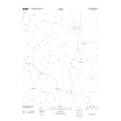
2013 Map of Buena Vista
USGS Topo · Published 2013About this map
The Big Sandy River meanders through this portion of Carroll County, anchoring a landscape defined by small rural settlements and a dense network of local roads. Small communities like Buena Vista and Westport serve as local hubs, connected by routes such as Westport Rd and Buena Vista Rd. The area is notably characterized by its numerous watercourses, including Little Bacon Cr, Moore Cr, and Indian Cr, which feed into the larger river system. Significant local history markers are found in the naming of roads like Taylor Cemetery Rd, Mount Zion Church Rd, and Humbles Church Ln, reflecting the foundational roles of early churches and family burial grounds in these Tennessee uplands. Smaller named locales such as Cross Roads, Spanish Grove, and the uniquely named Dollar highlight the dispersed nature of settlement in this region.
Find a feature on this map
85 named features on this map. Tap any name to fly to it.
Don’t see what you’re looking for? This feature index may not catch every label — zoom into the map to look around manually.
Map Details
Editions of this 2013 Buena Vista Map
This is the sole edition of this map. No revisions or reprints were ever made.
Other maps of this area

1936 · Clarksburg
USGS Topo · 1:24,000

1936 · Yuma
USGS Topo · 1:24,000

1936 · Seventeen Creek
USGS Topo · 1:24,000

1936 · Vale
USGS Topo · 1:24,000

1936 · Center Ridge
USGS Topo · 1:24,000

1936 · Bruceton
USGS Topo · 1:24,000

1936 · Cavvia
USGS Topo · 1:24,000

1936 · Buena Vista
USGS Topo · 1:24,000

1950 · Yuma
USGS Topo · 1:24,000

1950 · Palmer Shelter
USGS Topo · 1:24,000