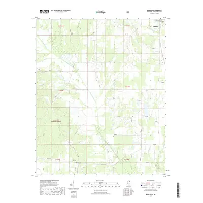
2018 Map of Buena Vista
USGS Topo · Published 2018About this map
Chuquatonchee Cr and its numerous tributaries, including Dicks Cr, Cane Cr, and Jolly Cr, define the drainage patterns of this Chickasaw County landscape. The southern reaches of Okolona appear in the northeast, while the unincorporated community of Buena Vista anchors the southwestern section. The territory between these settlements is primarily rural, characterized by the expansive tracts of the Tombigbee National Forest. This 2018 survey reveals a landscape deeply connected to its local history through several well-maintained burial grounds. Researchers can find the Confederate Cem and Citizens Cem near the northern border, while rural genealogy is further represented by Mount Moriah Cem, Pulliam Cem, and Snow Cem. The road network, including State Hwy 47 and Aberdeen Rd, connects these remote sites across the township lines of the t13s r4e and t13s r5e grids.
Find a feature on this map
54 named features on this map. Tap any name to fly to it.
Don’t see what you’re looking for? This feature index may not catch every label — zoom into the map to look around manually.
Map Details
Editions of this 2018 Buena Vista Map
This is the sole edition of this map. No revisions or reprints were ever made.
Other maps of this area

1953 · West Point
USGS Topo · 1:250,000

1956 · Tupelo
USGS Topo · 1:250,000

1958 · Tupelo
USGS Topo · 1:250,000

1958 · West Point
USGS Topo · 1:250,000

1959 · Van Vleet
USGS Topo · 1:62,500

1963 · West Point
USGS Topo · 1:250,000

1965 · Egypt
USGS Topo · 1:24,000

1966 · Shannon
USGS Topo · 1:24,000

1966 · Prairie
USGS Topo · 1:24,000

1966 · Troy SE
USGS Topo · 1:24,000