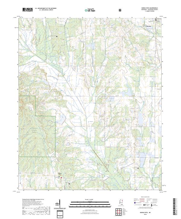
2024 Map of Buena Vista
USGS Topo · Published 2024About this map
Okolona anchors the northern edge of this Chickasaw County survey, where the Okolona Confederate Cem and Citizen's Cem reflect the area's deep local history. Further south, the rural settlement of Buena Vista serves as a focal point for the surrounding farm and forest lands, with the Buena Vista Cem and Pulliam Cem providing essential markers for genealogists tracing family ties in this part of Mississippi.
Find a feature on this map
58 named features on this map. Tap any name to fly to it.
Don’t see what you’re looking for? This feature index may not catch every label — zoom into the map to look around manually.
Map Details
Editions of this 2024 Buena Vista Map
This is the sole edition of this map. No revisions or reprints were ever made.
Other maps of this area

1953 · West Point
USGS Topo · 1:250,000

1956 · Tupelo
USGS Topo · 1:250,000

1958 · Tupelo
USGS Topo · 1:250,000

1958 · West Point
USGS Topo · 1:250,000

1959 · Van Vleet
USGS Topo · 1:62,500

1963 · West Point
USGS Topo · 1:250,000

1965 · Egypt
USGS Topo · 1:24,000

1966 · Shannon
USGS Topo · 1:24,000

1966 · Prairie
USGS Topo · 1:24,000

1966 · Troy SE
USGS Topo · 1:24,000