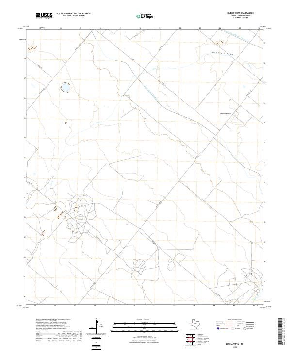
2022 Map of Buena Vista
USGS Topo · Published 2022About this map
Buena Vista serves as the focal point of this West Texas landscape, where the intersection of water management and transit routes defines the high desert environment of Pecos County. The irrigation legacy of the region is etched into the terrain by the Imperial Canal Number Three and Imperial Canal Number Five, which cut across the arid landscape to support local agricultural efforts. These man-made channels contrast with the natural drainage of the Diamond Y Draw and the winding course of Leon Cr.
Find a feature on this map
14 named features on this map. Tap any name to fly to it.
Don’t see what you’re looking for? This feature index may not catch every label — zoom into the map to look around manually.
Map Details
Editions of this 2022 Buena Vista Map
This is the sole edition of this map. No revisions or reprints were ever made.
Other maps of this area

1954 · Pecos
USGS Topo · 1:250,000

1957 · Pecos
USGS Topo · 1:250,000

1969 · Grandfalls
USGS Topo · 1:24,000
1972 · Buena Vista NE
USGS Topo · 1:24,000
1972 · Buena Vista SW
USGS Topo · 1:24,000
1972 · Owego
USGS Topo · 1:24,000
1972 · Buena Vista
USGS Topo · 1:24,000

1974 · Juan Cordona Lake
USGS Topo · 1:24,000
1974 · Diamond Y Spring NE
USGS Topo · 1:24,000
1974 · Diamond Y Spring SE
USGS Topo · 1:24,000