
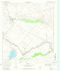
1969 Map of Grandfalls
USGS Topo · Published 1971About this map
The Grandfalls area in the late 1960s was defined by the intersection of high-desert oil exploration and a complex irrigation network. This survey captures a landscape where the Pecos River snakes along the southern border, feeding an intricate system of waterways such as the Van Carr Canal, Imperial Canal, and Imperial Ditch. These man-made features provided vital water to the arid terrain, supporting the community of Imperial near the prominent Imperial Reservoir.
Find a feature on this map
27 named features on this map. Tap any name to fly to it.
Don’t see what you’re looking for? This feature index may not catch every label — zoom into the map to look around manually.
Map Details
Editions of this 1969 Grandfalls Map
2 editions found
Other maps of this area

1954 · Pecos
USGS Topo · 1:250,000

1957 · Pecos
USGS Topo · 1:250,000

1969 · Ozark Lake
USGS Topo · 1:24,000

1969 · 7 L Ranch
USGS Topo · 1:24,000
1972 · Buena Vista
USGS Topo · 1:24,000
1974 · Diamond Y Spring NE
USGS Topo · 1:24,000
1974 · Imperial NW
USGS Topo · 1:24,000
1974 · Diamond Y Spring NW
USGS Topo · 1:24,000
1974 · Imperial
USGS Topo · 1:24,000
1986 · Crane
USGS Topo · 1:100,000