
1969 Map of Ozark Lake
USGS Topo · Published 1971About this map
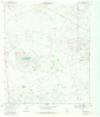
The arid landscape of Ward and Crane counties is defined by the extensive petroleum infrastructure of the late 1960s, notably within the Shipley Oil Field. This survey captures a region where the water supply is meticulously managed through a network of named water sources and numerous windmills, including the North Winters Windmill, Gyp Flats Windmill, and Pigman Windmill. At the heart of this industrial terrain lies Ozark Lake, accompanied by a Chemical Plant and nearby Substa, illustrating the intersection of natural features and energy extraction. The small settlement of Royalty sits in the southwest corner, while the broader geography is punctuated by individual homesteads and landmarks like Estes Ranch and Gyp Flats. This document serves as a detailed record of the West Texas oil economy and the survival of ranching operations like the Old Ranch Well in a challenging environment.
Find a feature on this map
28 named features on this map. Tap any name to fly to it.
Don’t see what you’re looking for? This feature index may not catch every label — zoom into the map to look around manually.
Map Details
Editions of this 1969 Ozark Lake Map
2 editions found
Other maps of this area

1954 · Pecos
USGS Topo · 1:250,000

1957 · Pecos
USGS Topo · 1:250,000

1964 · Penwell SW
USGS Topo · 1:24,000

1968 · Monahans SE
USGS Topo · 1:24,000

1969 · Grandfalls
USGS Topo · 1:24,000

1969 · Monahans
USGS Topo · 1:24,000

1969 · 7 L Ranch
USGS Topo · 1:24,000
1974 · Imperial NW
USGS Topo · 1:24,000
1974 · Imperial
USGS Topo · 1:24,000
1986 · Crane
USGS Topo · 1:100,000