
1964 Map of Penwell SW
USGS Topo · Published 1967About this map
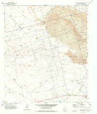
Industrial development in Crane County is prominently defined by the Armer Oil Field, where a dense network of drilling infrastructure and access roads cuts through the natural terrain of the Sand Hills. This mid-1960s survey reveals an economy centered on resource extraction, characterized by an extensive system of a Pipeline and an Aqueduct that crisscross the landscape. The terrain itself, featuring the Running W and shifting sands, is dotted with specialized facilities like the Warren Gas Plant and various Pumping Sta locations. Local operations are further marked by a Sand Windmill and scattered Gravel Pit sites, reflecting the practical necessities of maintainence and expansion in this arid West Texas environment. The map provides a clear picture of the physical footprint of the mid-century petroleum industry before later consolidation changed the oil field landscape.
Find a feature on this map
11 named features on this map. Tap any name to fly to it.
Don’t see what you’re looking for? This feature index may not catch every label — zoom into the map to look around manually.
Map Details
Editions of this 1964 Penwell SW Map
This is the sole edition of this map. No revisions or reprints were ever made.
Other maps of this area

1954 · Pecos
USGS Topo · 1:250,000

1957 · Pecos
USGS Topo · 1:250,000

1964 · Metz
USGS Topo · 1:24,000

1964 · Penwell
USGS Topo · 1:24,000

1964 · Penwell SE
USGS Topo · 1:24,000

1968 · Monahans SE
USGS Topo · 1:24,000

1968 · Cowden Place
USGS Topo · 1:24,000

1969 · Ozark Lake
USGS Topo · 1:24,000

1974 · Tubbs Corner
USGS Topo · 1:24,000
1974 · Imperial NW
USGS Topo · 1:24,000