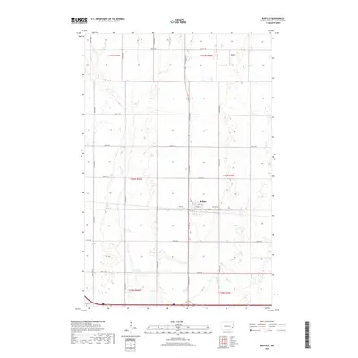
2020 Map of Buffalo
USGS Topo · Published 2020About this map
Buffalo serves as the primary hub of this Cass County landscape, situated where the local road network of Main St and Front St meets the section lines of the surrounding townships. The settlement is characterized by a precise grid, including residential streets like Pearl St N and 3rd St N, while the Buffalo Cem is located just to the east. Outside the town limits, the topography is defined by the winding course of the Maple River, which cuts across the prairie sections of t140n r55w and t141n r55w. This river valley provides a natural break in the otherwise rigid rectangular survey system that governs the region. To the north, Grieve Airport and a series of county roads like Co Rd 32 facilitate travel through this agricultural corridor, illustrating the modern rural infrastructure of the Red River Valley hinterlands.
Find a feature on this map
30 named features on this map. Tap any name to fly to it.
Don’t see what you’re looking for? This feature index may not catch every label — zoom into the map to look around manually.
Map Details
Editions of this 2020 Buffalo Map
This is the sole edition of this map. No revisions or reprints were ever made.
Other maps of this area

1895 · Casselton
USGS Topo · 1:125,000

1897 · Tower
USGS Topo · 1:125,000

1897 · Casselton
USGS Topo · 1:125,000

1952 · Grand Forks
USGS Topo · 1:250,000

1953 · Fargo
USGS Topo · 1:250,000

1956 · Fargo
USGS Topo · 1:250,000

1956 · Grand Forks
USGS Topo · 1:250,000

1965 · Alice
USGS Topo · 1:24,000

1965 · Tower City SW
USGS Topo · 1:24,000

1966 · Grand Forks
USGS Topo · 1:250,000