2024 Map of Buffalo
USGS Topo · Published 2024About this map
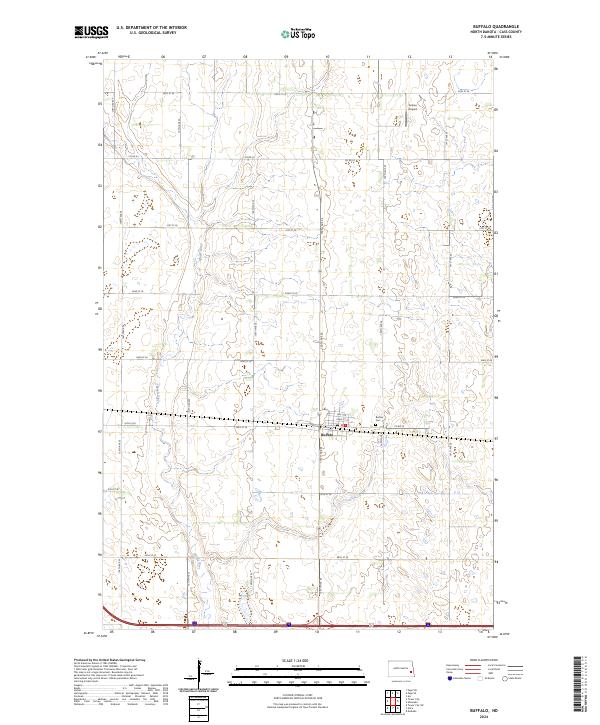
Buffalo serves as the central hub of this Cass County landscape, situated where the grid of local section roads meets the primary east-west corridor of Main St and Front St. The settlement's layout is clearly defined by local streets such as 3rd St N and Pearl St N, with the Buffalo Cem located just to the east. This 2024 survey captures the agrarian character of the Red River Valley, where the winding course of the Maple River provides a natural contrast to the rigid geometry of the surrounding section lines, including 136th Ave SE and 29th St SE. Further north, Grieve Airport represents the local aviation infrastructure that supports the region's agricultural operations. The map details a landscape transition from the river bottom to the high plains, illustrating the continued importance of historical township and range boundaries like t140n r54w in modern land management.
Find a feature on this map
29 named features on this map. Tap any name to fly to it.
Don’t see what you’re looking for? This feature index may not catch every label — zoom into the map to look around manually.
Map Details
Editions of this 2024 Buffalo Map
This is the sole edition of this map. No revisions or reprints were ever made.