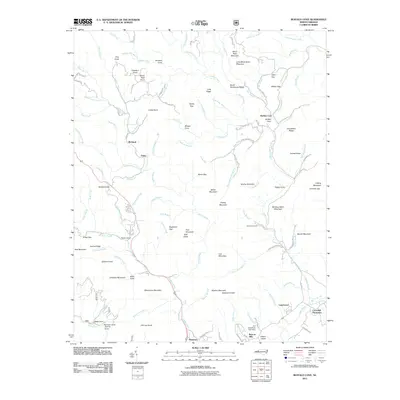
2011 Map of Buffalo Cove
USGS Topo · Published 2011About this map
Cloverhill Plantation and Legerwood anchor the southeastern corner of this terrain, where the Yadkin River flows through the lowlands of Happy Valley. This map captures a landscape defined by significant elevation changes, from the deep hollows of Deep Cove and Tommy Cove to the heights of Winding Stairs Mountain and White Rock Mountain. The settlement patterns follow the water, with Richland and Finley situated along the many branches feeding the river system. North of the river, the landscape is a network of named ridges and gaps like Harris Gap and Days Gap, indicating historical transit routes through the high country. Near the southern edge, infrastructure and recreation are represented by the A A Rauchfuss Lake Dam and Camp Carolwood, providing a detailed look at land use in the foothills as it existed in the early twenty-first century.
Find a feature on this map
126 named features on this map. Tap any name to fly to it.
Don’t see what you’re looking for? This feature index may not catch every label — zoom into the map to look around manually.
Map Details
Editions of this 2011 Buffalo Cove Map
This is the sole edition of this map. No revisions or reprints were ever made.
Other maps of this area

1889 · Wilkesboro
USGS Topo · 1:125,000

1891 · Wilkesboro
USGS Topo · 1:125,000

1893 · Cranberry
USGS Topo · 1:125,000

1895 · Hickory
USGS Topo · 1:125,000

1895 · Cranberry
USGS Topo · 1:125,000

1899 · Cranberry
USGS Topo · 1:125,000

1902 · Cranberry
USGS Topo · 1:125,000

1905 · Morganton
USGS Topo · 1:125,000

1934 · Boone
USGS Topo · 1:24,000

1936 · Blowing Rock
USGS Topo · 1:48,000