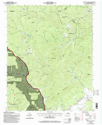
1994 Map of Buffalo Cove
USGS Topo · Published 1998About this map
The Yadkin River and its numerous mountain tributaries define this landscape at the intersection of Caldwell, Wilkes, and Watauga counties. The 1994 revision shows a terrain shaped by deep coves and prominent ridges, where settlements like Richland, Buffalo Cove, and Darby follow the narrow valleys. A strong sense of community history is evident through the concentration of rural institutions, particularly along the southern reaches of the map near Patterson. Here, the Patterson School sits near the Chapel of Rest, marking a long-established center of local education and faith.
Find a feature on this map
111 named features on this map. Tap any name to fly to it.
Don’t see what you’re looking for? This feature index may not catch every label — zoom into the map to look around manually.
Map Details
Editions of this 1994 Buffalo Cove Map
This is the sole edition of this map. No revisions or reprints were ever made.
Other maps of this area

1889 · Wilkesboro
USGS Topo · 1:125,000

1891 · Wilkesboro
USGS Topo · 1:125,000

1893 · Cranberry
USGS Topo · 1:125,000

1895 · Hickory
USGS Topo · 1:125,000

1895 · Cranberry
USGS Topo · 1:125,000

1899 · Cranberry
USGS Topo · 1:125,000

1902 · Cranberry
USGS Topo · 1:125,000

1905 · Morganton
USGS Topo · 1:125,000

1934 · Boone
USGS Topo · 1:24,000

1936 · Blowing Rock
USGS Topo · 1:48,000