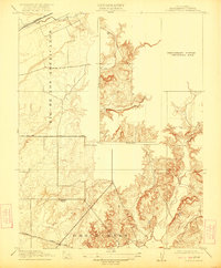
1916 Map of Buffalo Creek
USGS Topo · Published 1922About this map
Rio de los Americanos defines the western landscape of this territory, where early Sacramento County land grants like the Omochumne area begin to transition into the foothills. The map reveals a rural infrastructure centered on the Sacramento and Jackson Road and the (Placerville Br) railroad line. This 1916 edition is particularly notable for its large "Preliminary Edition Unsurveyed Area" in the center, capturing a moment when the USGS was still actively documenting the topographic details of the drainage basins for Deer Creek and Carson Creek. Local community life is anchored by the Highland School, situated at a key crossroads, providing a specific point of interest for genealogists tracing early educational sites in the region before modern suburban expansion.
Find a feature on this map
8 named features on this map. Tap any name to fly to it.
Don’t see what you’re looking for? This feature index may not catch every label — zoom into the map to look around manually.
Map Details
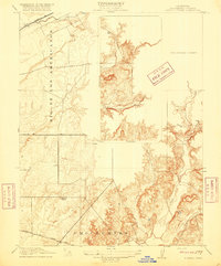
Editions of this 1916 Buffalo Creek Map
2 editions found
Other maps of this area

1891 · Sacramento
USGS Topo · 1:125,000

1892 · Sacramento
USGS Topo · 1:125,000

1893 · Sacramento
USGS Topo · 1:125,000

1894 · Lodi
USGS Topo · 1:125,000

1902 · Fairoaks
USGS Topo · 1:62,500

1908 · Buffalo Creek
USGS Topo · 1:31,680

1909 · Elk Grove
USGS Topo · 1:31,680

1909 · Carbondale
USGS Topo · 1:31,680

1909 · Cosumnes
USGS Topo · 1:31,680

1911 · Mills
USGS Topo · 1:31,680