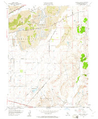
1954 Map of Buffalo Creek
USGS Topo · Published 1961About this map
Dredge tailings dominate the northern landscape of this 1954 survey, bearing silent witness to the intensive gold mining operations that once reshaped the terrain of Rio De Los Americanos. This industrial history sits in contrast to the burgeoning military presence of Mather Air Force Base along the western edge, marking a shift in the region's economic and strategic importance during the mid-twentieth century.
Find a feature on this map
25 named features on this map. Tap any name to fly to it.
Don’t see what you’re looking for? This feature index may not catch every label — zoom into the map to look around manually.
Map Details
Editions of this 1954 Buffalo Creek Map
2 editions found
Other maps of this area

1891 · Sacramento
USGS Topo · 1:125,000

1892 · Sacramento
USGS Topo · 1:125,000

1893 · Sacramento
USGS Topo · 1:125,000

1894 · Lodi
USGS Topo · 1:125,000

1902 · Fairoaks
USGS Topo · 1:62,500

1908 · Buffalo Creek
USGS Topo · 1:31,680

1909 · Elk Grove
USGS Topo · 1:31,680

1909 · Carbondale
USGS Topo · 1:31,680

1909 · Cosumnes
USGS Topo · 1:31,680

1911 · Mills
USGS Topo · 1:31,680