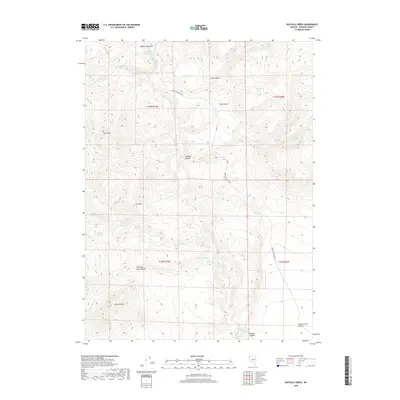
2018 Map of Buffalo Creek
USGS Topo · Published 2018About this map
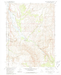
Buffalo Meadows sits at the northern edge of this high-desert landscape in Washoe County, where a network of seasonal washes and spring-fed canyons defines the terrain. The presence of numerous named water sources, such as Trail Canyon Spring, Rosebush Spring, and Rimrock Spring, indicates the critical importance of reliable water in this arid environment. The map details a transition from prominent peaks like Grass Mtn and Lone Mtn down toward the southern expanse of the Smoke Creek Desert. Navigating this territory relies on Buffalo Meadows Rd, which skirts several deep incisions in the earth, including Crooked Canyon and Chimney Rock Canyon. This 2018 survey illustrates the persistent geography of the Great Basin, where isolated springs and rocky outcrops like Chimney Rock serve as primary landmarks in a sparsely populated region.
Find a feature on this map
28 named features on this map. Tap any name to fly to it.
Don’t see what you’re looking for? This feature index may not catch every label — zoom into the map to look around manually.
Map Details
Editions of this 2018 Buffalo Creek Map
This is the sole edition of this map. No revisions or reprints were ever made.
Other maps of this area

1886 · Granite Range
USGS Topo · 1:250,000

1894 · Granite Range
USGS Topo · 1:250,000

1955 · Lovelock
USGS Topo · 1:250,000

1959 · Lovelock
USGS Topo · 1:250,000

1980 · Salt Marsh
USGS Topo · 1:24,000
1980 · Buffalo Creek
USGS Topo · 1:24,000
1980 · Mixie Flat
USGS Topo · 1:24,000
1980 · Hole In The Ground
USGS Topo · 1:24,000

1980 · Hog Spring
USGS Topo · 1:24,000
1980 · Smoke Creek Ranch
USGS Topo · 1:24,000