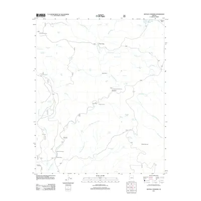
2011 Map of Buffalo Crossing
USGS Topo · Published 2011About this map
The East Fork Black River carves a deep path through this high-country landscape, serving as the central artery for a network of forest camps and water sources. Buffalo Crossing and Three Forks emerge as primary landmarks where these watercourses converge, anchoring a region defined by its reliance on developed water tanks such as Triangle Tank and Last Chance Tank. The distribution of these features, alongside remote sites like Cienega Redondo Camp, reflects a landscape managed for seasonal grazing and forestry.
Find a feature on this map
63 named features on this map. Tap any name to fly to it.
Don’t see what you’re looking for? This feature index may not catch every label — zoom into the map to look around manually.
Map Details
Editions of this 2011 Buffalo Crossing Map
This is the sole edition of this map. No revisions or reprints were ever made.
Other maps of this area

1922 · Nutrioso
USGS Topo · 1:125,000

1954 · Clifton
USGS Topo · 1:250,000

1957 · Clifton
USGS Topo · 1:250,000

1958 · Clifton
USGS Topo · 1:250,000

1958 · Alpine
USGS Topo · 1:62,500

1958 · Hannagan Meadow
USGS Topo · 1:62,500

1958 · Big Lake
USGS Topo · 1:62,500

1961 · Blue
USGS Topo · 1:62,500

1962 · Clifton
USGS Topo · 1:250,000
1981 · Nutrioso
USGS Topo · 1:100,000