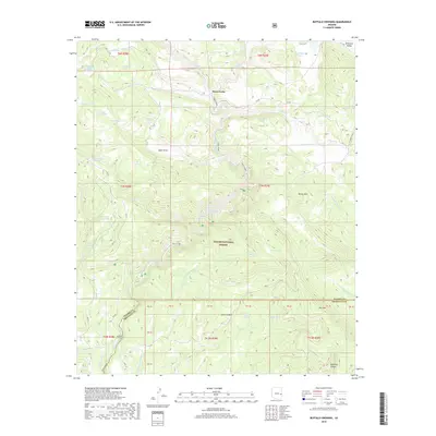
2018 Map of Buffalo Crossing
USGS Topo · Published 2018About this map
Apache National Forest dominates this high-country landscape, where the headwaters of the N-Fork-E-Fork Black River converge at Three Forks. The terrain is defined by a sophisticated network of livestock and wildlife management, evidenced by the numerous tanks and springs scattered across the high ridges and canyons. From Platt Tank in the north to the southern reaches of Buffalo Crossing, the map illustrates a remote wilderness managed for conservation and ranching.
Find a feature on this map
64 named features on this map. Tap any name to fly to it.
Don’t see what you’re looking for? This feature index may not catch every label — zoom into the map to look around manually.
Map Details
Editions of this 2018 Buffalo Crossing Map
This is the sole edition of this map. No revisions or reprints were ever made.
Other maps of this area

1922 · Nutrioso
USGS Topo · 1:125,000

1954 · Clifton
USGS Topo · 1:250,000

1957 · Clifton
USGS Topo · 1:250,000

1958 · Clifton
USGS Topo · 1:250,000

1958 · Alpine
USGS Topo · 1:62,500

1958 · Hannagan Meadow
USGS Topo · 1:62,500

1958 · Big Lake
USGS Topo · 1:62,500

1961 · Blue
USGS Topo · 1:62,500

1962 · Clifton
USGS Topo · 1:250,000
1981 · Nutrioso
USGS Topo · 1:100,000