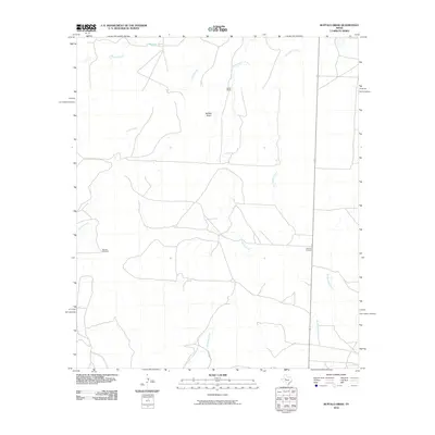
2010 Map of Buffalo Draw
USGS Topo · Published 2010About this map
Buffalo Draw and a complex network of seasonal drainages define this Sterling County landscape at the beginning of the twenty-first century. The terrain is marked by the presence of the Spade Ranch and the vital water infrastructure necessary for ranching, including Hyman Tank and the Monitor Windmill. These features indicate a continued reliance on traditional West Texas land-use patterns even as modern digital surveying techniques captured the area. Evidence of early settlement persists through the Lolanthe Cemetery, which stands as a quiet marker of the community's history amidst the meandering paths of Hackberry Creek and Mustang Creek. This map preserves the distribution of ranching facilities and rural cemeteries before further land division or environmental shifts could alter the site's character.
Find a feature on this map
10 named features on this map. Tap any name to fly to it.
Don’t see what you’re looking for? This feature index may not catch every label — zoom into the map to look around manually.
Map Details
Editions of this 2010 Buffalo Draw Map
This is the sole edition of this map. No revisions or reprints were ever made.
Other maps of this area

1954 · Big Spring
USGS Topo · 1:250,000

1954 · San Angelo
USGS Topo · 1:250,000

1958 · San Angelo
USGS Topo · 1:250,000

1958 · Big Spring
USGS Topo · 1:250,000

1959 · Spade Ranch
USGS Topo · 1:24,000

1959 · McWhorter Mountain
USGS Topo · 1:24,000

1962 · Hyman NE
USGS Topo · 1:24,000

1963 · Cumbie Draw NE
USGS Topo · 1:24,000

1963 · Buffalo Draw
USGS Topo · 1:24,000

1963 · Hayrick Mountain
USGS Topo · 1:24,000