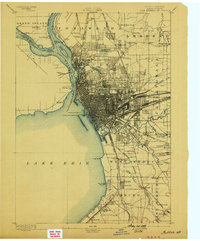
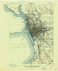
1973 Map of Buffalo
USGS Topo · Published 1973About this map
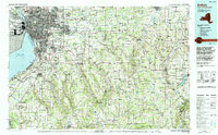
Industrial and maritime hubs define this border region along Lake Erie, where the Niagara River and the Welland Canal facilitate international commerce between the United States and Canada. The urban core of Buffalo, Cheektowaga, and Lackawanna stands as a dense terminal for major transportation routes, including the New York State Thruway and a massive rail network featuring the Erie Lackawanna and Pennsylvania lines. Southward, the terrain shifts into the timbered uplands of Allegany State Park and the glacial valleys surrounding Chautauqua Lake. The landscape reveals a complex economy of lakeside industry at Dunkirk and Port Colborne contrasted with the deep river valleys of the Allegheny River and Cattaraugus Creek, showing the 1970s balance of heavy manufacture and protected state parklands.
Find a feature on this map
80 named features on this map. Tap any name to fly to it.
Don’t see what you’re looking for? This feature index may not catch every label — zoom into the map to look around manually.
Map Details
Editions of this 1973 Buffalo Map
This is the sole edition of this map. No revisions or reprints were ever made.
Historical Maps of Buffalo Through Time
8 maps found