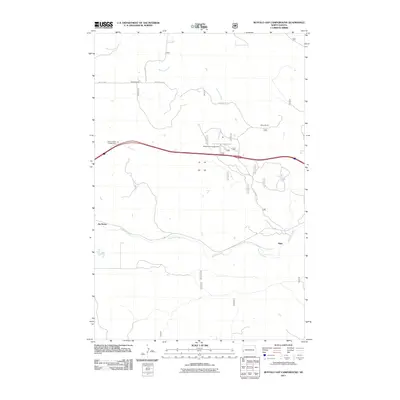
2011 Map of Buffalo Gap Campground
USGS Topo · Published 2011About this map
Buffalo Gap Campground anchors the northern reaches of this North Dakota landscape, situated along the corridor of Buffalo Gap Rd. The map illustrates the character of Golden Valley County's rangelands in the early 21st century, where large-scale landholdings like Adams Ranch and Myers Ranch define the settlement pattern. These ranches are linked by a network of secondary roads including 30th St SW and Wannagan Creek Rd, showing how modern livestock operations utilize the natural draws of the terrain.
Find a feature on this map
12 named features on this map. Tap any name to fly to it.
Don’t see what you’re looking for? This feature index may not catch every label — zoom into the map to look around manually.
Map Details
Editions of this 2011 Buffalo Gap Campground Map
This is the sole edition of this map. No revisions or reprints were ever made.
Other maps of this area

1953 · Dickinson
USGS Topo · 1:250,000

1953 · Watford City
USGS Topo · 1:250,000

1957 · Dickinson
USGS Topo · 1:250,000

1957 · Watford City
USGS Topo · 1:250,000

1967 · Watford City
USGS Topo · 1:250,000

1970 · Wannagan Creek East
USGS Topo · 1:24,000

1970 · Medora
USGS Topo · 1:24,000

1974 · West Twin Butte
USGS Topo · 1:24,000

1974 · Wannagan Creek West
USGS Topo · 1:24,000

1979 · Sentinel Butte SE
USGS Topo · 1:24,000