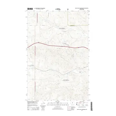
2014 Map of Buffalo Gap Campground
USGS Topo · Published 2014About this map
The Little Missouri National Grassland dominates this landscape along the border of Billings and Golden Valley counties. This terrain is characterized by a dense network of drainages, most notably Knutson Cr in the north and Andrews Cr winding through the south. The settlement of De Mores and the location of Rider serve as primary anchors for local history and genealogy research in this corner of North Dakota. Modern infrastructure is represented by the path of Buffalo Gap Campground and historical thoroughfares like Old Hwy 10. The map also illustrates the transition of local transit from Buffalo Gap Rd to more recent county routes, reflecting the persistent but sparse human presence in this grazing-heavy environment.
Find a feature on this map
14 named features on this map. Tap any name to fly to it.
Don’t see what you’re looking for? This feature index may not catch every label — zoom into the map to look around manually.
Map Details
Editions of this 2014 Buffalo Gap Campground Map
This is the sole edition of this map. No revisions or reprints were ever made.
Other maps of this area

1953 · Dickinson
USGS Topo · 1:250,000

1953 · Watford City
USGS Topo · 1:250,000

1957 · Dickinson
USGS Topo · 1:250,000

1957 · Watford City
USGS Topo · 1:250,000

1967 · Watford City
USGS Topo · 1:250,000

1970 · Wannagan Creek East
USGS Topo · 1:24,000

1970 · Medora
USGS Topo · 1:24,000

1974 · West Twin Butte
USGS Topo · 1:24,000

1974 · Wannagan Creek West
USGS Topo · 1:24,000

1979 · Sentinel Butte SE
USGS Topo · 1:24,000