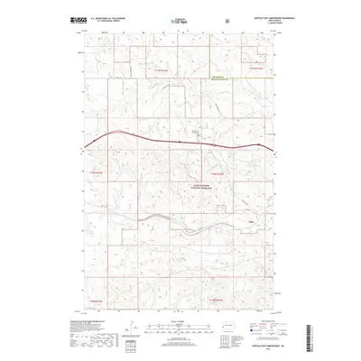
2017 Map of Buffalo Gap Campground
USGS Topo · Published 2017About this map
Little Missouri National Grassland dominates this landscape along the border of Billings and Golden Valley counties. The terrain is defined by the drainage basins of Knutson Creek and Andrews Creek, which carve through the high prairie. Human presence is concentrated near the transit corridors, most notably at the Buffalo Gap Campground and the small settlement of Rider. The mapping reveals a distinct layering of transportation history, where modern infrastructure runs parallel to older routes like Old Hwy 10. Local travel is facilitated by a network of rural arteries such as Buffalo Gap Road and Wannagan Creek Road, which provide access to the vast grazing lands of the western Dakotas. This survey illustrates the relationship between public land management and the sparse, purposeful settlement patterns of the region.
Find a feature on this map
10 named features on this map. Tap any name to fly to it.
Don’t see what you’re looking for? This feature index may not catch every label — zoom into the map to look around manually.
Map Details
Editions of this 2017 Buffalo Gap Campground Map
This is the sole edition of this map. No revisions or reprints were ever made.
Other maps of this area

1953 · Dickinson
USGS Topo · 1:250,000

1953 · Watford City
USGS Topo · 1:250,000

1957 · Dickinson
USGS Topo · 1:250,000

1957 · Watford City
USGS Topo · 1:250,000

1967 · Watford City
USGS Topo · 1:250,000

1970 · Wannagan Creek East
USGS Topo · 1:24,000

1970 · Medora
USGS Topo · 1:24,000

1974 · West Twin Butte
USGS Topo · 1:24,000

1974 · Wannagan Creek West
USGS Topo · 1:24,000

1979 · Sentinel Butte SE
USGS Topo · 1:24,000