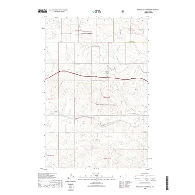
2020 Map of Buffalo Gap Campground
USGS Topo · Published 2020About this map
Little Missouri National Grassland dominates this section of the North Dakota badlands, where the landscape is defined by the winding paths of Andrews Cr and Knutson Cr. The map captures a transition in regional transportation, showing the proximity of the modern interstate corridor to the historic route of Old Hwy 10. This old highway passes through the small settlement areas of De Mores and Rider, reflecting the early 20th-century automotive and rail heritage of the region. The map provides specific detail for the Buffalo Gap Campground, including its associated access routes like Buffalo Gap Loop and Buffalo Gap Spur. These features, along with the numerous unnamed drainages and elevation contours, illustrate the complex topography that characterizes the breaks between the plains and the river valleys in this corner of Golden Valley and Billings counties.
Find a feature on this map
21 named features on this map. Tap any name to fly to it.
Don’t see what you’re looking for? This feature index may not catch every label — zoom into the map to look around manually.
Map Details
Editions of this 2020 Buffalo Gap Campground Map
This is the sole edition of this map. No revisions or reprints were ever made.
Other maps of this area

1953 · Dickinson
USGS Topo · 1:250,000

1953 · Watford City
USGS Topo · 1:250,000

1957 · Dickinson
USGS Topo · 1:250,000

1957 · Watford City
USGS Topo · 1:250,000

1967 · Watford City
USGS Topo · 1:250,000

1970 · Wannagan Creek East
USGS Topo · 1:24,000

1970 · Medora
USGS Topo · 1:24,000

1974 · West Twin Butte
USGS Topo · 1:24,000

1974 · Wannagan Creek West
USGS Topo · 1:24,000

1979 · Sentinel Butte SE
USGS Topo · 1:24,000