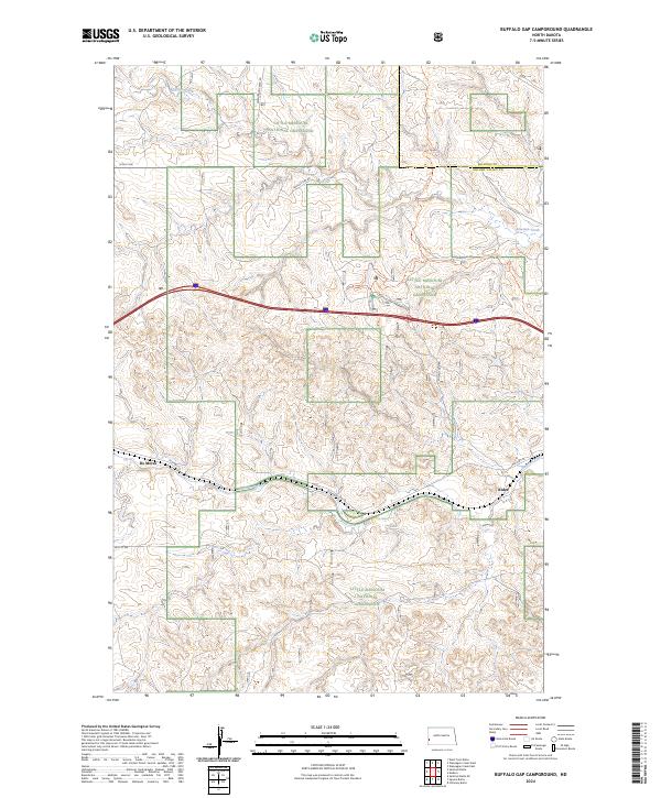
2024 Map of Buffalo Gap Campground
USGS Topo · Published 2024About this map
Little Missouri National Grassland dominates this corner of Golden Valley County, where the terrain transitions between high plateaus and the drainage basins of Knutson Creek and Andrews Creek. Modern recreation and historic transit paths intersect here, centered around the Buffalo Gap Campground. The map preserves the alignment of Old Highway 10, a precursor to the interstate that crosses the landscape alongside contemporary routes like 30th St SW. The small settlements of De Mores and Rider appear near the southwestern and eastern margins respectively, marking traditional focal points in this open country. Hikers and researchers can trace the winding course of the Buffalo Gap Trl and its associated Buffalo Gap Spur Trl, which provide access to the expansive public lands managed across these townships.
Find a feature on this map
19 named features on this map. Tap any name to fly to it.
Don’t see what you’re looking for? This feature index may not catch every label — zoom into the map to look around manually.
Map Details
Editions of this 2024 Buffalo Gap Campground Map
This is the sole edition of this map. No revisions or reprints were ever made.
Other maps of this area

1953 · Dickinson
USGS Topo · 1:250,000

1953 · Watford City
USGS Topo · 1:250,000

1957 · Dickinson
USGS Topo · 1:250,000

1957 · Watford City
USGS Topo · 1:250,000

1967 · Watford City
USGS Topo · 1:250,000

1970 · Wannagan Creek East
USGS Topo · 1:24,000

1970 · Medora
USGS Topo · 1:24,000

1974 · West Twin Butte
USGS Topo · 1:24,000

1974 · Wannagan Creek West
USGS Topo · 1:24,000

1979 · Sentinel Butte SE
USGS Topo · 1:24,000