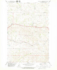
1979 Map of Buffalo Gap Campground
USGS Topo · Published 1979About this map
Buffalo Gap Campground stands as a focal point in this 1970s survey of the North Dakota badlands, situated near the boundary where Billings Co meets Golden Valley Co. The landscape is defined by the winding paths of Knutson Creek and Andrews Creek, which cut through the Sentinel terrain. This era of Western development is evidenced by the prominent infrastructure of the Burlington Northern railroad corridor, including the station or siding at Rider.
Find a feature on this map
15 named features on this map. Tap any name to fly to it.
Don’t see what you’re looking for? This feature index may not catch every label — zoom into the map to look around manually.
Map Details
Editions of this 1979 Buffalo Gap Campground Map
This is the sole edition of this map. No revisions or reprints were ever made.
Other maps of this area

1953 · Dickinson
USGS Topo · 1:250,000

1953 · Watford City
USGS Topo · 1:250,000

1957 · Dickinson
USGS Topo · 1:250,000

1957 · Watford City
USGS Topo · 1:250,000

1967 · Watford City
USGS Topo · 1:250,000

1970 · Wannagan Creek East
USGS Topo · 1:24,000

1970 · Medora
USGS Topo · 1:24,000

1974 · West Twin Butte
USGS Topo · 1:24,000

1974 · Wannagan Creek West
USGS Topo · 1:24,000

1979 · Sentinel Butte SE
USGS Topo · 1:24,000