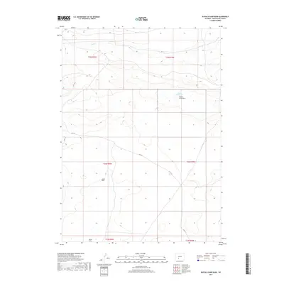
2017 Map of Buffalo Hump Basin
USGS Topo · Published 2017About this map
Buffalo Hump Basin and the adjacent Alkali Basin define the high desert topography of this region in Sweetwater County. The landscape is marked by seasonal water features and drainage systems, including Bush Cr in the northern reaches and Alkali Draw to the south. Central to this survey is Buffalo Hump Lake, a distinct water body situated within the basin's depression. The infrastructure of the area consists primarily of rural routes such as Bar X Rd, Co Rd 15, and Co Rd 4-21, which provide the only navigational markers across this section of the Great Divide Basin. This 2017 U.S. Geological Survey record indicates a terrain dominated by low-lying basins and ephemeral hydrology rather than permanent settlements, reflecting the sparse human footprint in this part of Wyoming.
Find a feature on this map
14 named features on this map. Tap any name to fly to it.
Don’t see what you’re looking for? This feature index may not catch every label — zoom into the map to look around manually.
Map Details
Editions of this 2017 Buffalo Hump Basin Map
This is the sole edition of this map. No revisions or reprints were ever made.
Other maps of this area

1954 · Rock Springs
USGS Topo · 1:250,000

1955 · Lander
USGS Topo · 1:250,000

1958 · Lander
USGS Topo · 1:250,000

1958 · Rock Springs
USGS Topo · 1:250,000

1958 · Twelvemile Well
USGS Topo · 1:62,500

1958 · The Pinnacles
USGS Topo · 1:62,500

1960 · Red Lake
USGS Topo · 1:62,500

1960 · Five Fingers Butte
USGS Topo · 1:62,500

1961 · Lander
USGS Topo · 1:250,000

1962 · Rock Springs
USGS Topo · 1:250,000