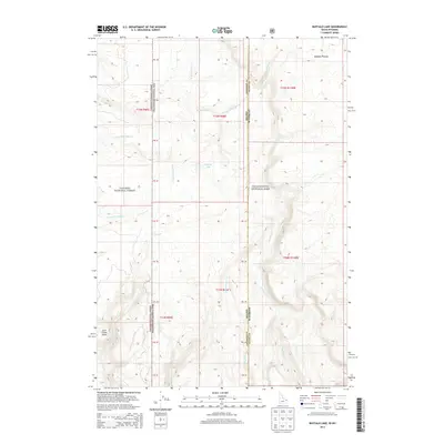
2013 Map of Buffalo Lake
USGS Topo · Published 2013About this map
Yellowstone National Park and the Targhee National Forest meet at a high-elevation boundary where the Idaho-Wyoming state line intersects the Fremont and Teton County borders. This 2013 survey of the Buffalo Lake area reveals a landscape defined by its hydrology, with drainage systems such as Boundary Creek, Cascade Creek, and Little Robinson Creek carving through the volcanic highlands. The Madison Plateau dominates the northeastern corner, providing a stark geographic contrast to the prominent rise of Snow Creek Butte in the southwest. The presence of numerous unnamed survey markers (PB 37 through PB 42) indicates the systematic management of this wilderness interface. Remote and largely undeveloped, the terrain shows the intricate network of headwaters for the South Fork Partridge Creek and North Fork Partridge Creek, illustrating the source waters that feed the region’s larger river systems.
Find a feature on this map
28 named features on this map. Tap any name to fly to it.
Don’t see what you’re looking for? This feature index may not catch every label — zoom into the map to look around manually.
Map Details
Editions of this 2013 Buffalo Lake Map
This is the sole edition of this map. No revisions or reprints were ever made.
Other maps of this area

1886 · Shoshone
USGS Topo · 1:125,000

1888 · Shoshone
USGS Topo · 1:125,000

1895 · Shoshone
USGS Topo · 1:125,000

1901 · Shoshone
USGS Topo · 1:125,000

1908 · Shoshone
USGS Topo · 1:125,000

1911 · Shoshone
USGS Topo · 1:125,000

1955 · Ashton
USGS Topo · 1:250,000

1956 · Old Faithful
USGS Topo · 1:62,500

1956 · Grassy Lake Reservoir
USGS Topo · 1:62,500

1957 · Warm River Butte
USGS Topo · 1:62,500