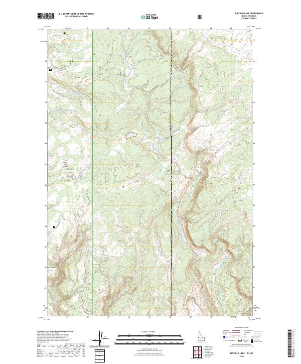
2023 Map of Buffalo Lake
USGS Topo · Published 2023About this map
Yellowstone National Park and Targhee National Forest meet along the Idaho-Wyoming state line on this modern topographic study. The landscape is defined by the massive Island Park Caldera, which shapes the hydrology and topography of the high country. Drainage networks including Robinson Creek, Boundary Creek, and the South Fork Partridge Creek flow through timbered lands where forestry and wilderness management overlap. A small number of specialized access routes like Log Haul 4 Spur 2 and Fish Greek Spur 10 suggest the intersection of industrial use and conservation. From the heights of Snow Creek Butte to the drainages of Little Robinson Creek, the map details a remote transition zone where Fremont County, Idaho meets Teton County, Wyoming.
Find a feature on this map
32 named features on this map. Tap any name to fly to it.
Don’t see what you’re looking for? This feature index may not catch every label — zoom into the map to look around manually.
Map Details
Editions of this 2023 Buffalo Lake Map
This is the sole edition of this map. No revisions or reprints were ever made.
Other maps of this area

1886 · Shoshone
USGS Topo · 1:125,000

1888 · Shoshone
USGS Topo · 1:125,000

1895 · Shoshone
USGS Topo · 1:125,000

1901 · Shoshone
USGS Topo · 1:125,000

1908 · Shoshone
USGS Topo · 1:125,000

1911 · Shoshone
USGS Topo · 1:125,000

1955 · Ashton
USGS Topo · 1:250,000

1956 · Old Faithful
USGS Topo · 1:62,500

1956 · Grassy Lake Reservoir
USGS Topo · 1:62,500

1957 · Warm River Butte
USGS Topo · 1:62,500