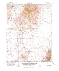
1954 Map of Buffalo Mtn
USGS Topo · Published 1974About this map
Mining operations for mercury and other minerals define the mid-century industrial landscape of the Humboldt Range, as seen in this 1954 survey. Operations like the Nevada Quicksilver Mine, Pershing Quicksilver Mine, and Hollywood Mine are clustered around the central ridges, connected by a network of unimproved roads and shafts. The map documents a rugged transition from the high peaks of Buffalo Mtn and Cornish Peak down to the wide, arid expanses of Packard Flat and the Alkali Flat. Historical transportation routes are prominent, with the Old Emigrant Jeep Trail and Emigrant Road cutting across the Antelope Valley. Water sources, critical in this high desert environment, are precisely noted at locations such as Buffalo Springs, Black Knob Spring, and Antelope Spr. An Airway Beacon stands as a modern navigation aid amidst the traditional landmarks like Chocolate Butte.
Find a feature on this map
28 named features on this map. Tap any name to fly to it.
Don’t see what you’re looking for? This feature index may not catch every label — zoom into the map to look around manually.
Map Details
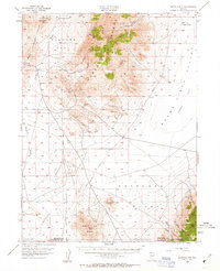
Editions of this 1954 Buffalo Mtn Map
3 editions found
Other maps of this area

1908 · Carson Sink
USGS Topo · 1:250,000

1910 · Carson Sink
USGS Topo · 1:250,000

1931 · Lovelock
USGS Topo · 1:250,000

1932 · Sonoma Range
USGS Topo · 1:250,000

1935 · Lovelock
USGS Topo · 1:250,000

1939 · Sonoma Range
USGS Topo · 1:250,000

1954 · Unionville
USGS Topo · 1:62,500

1954 · Buffalo Mtn
USGS Topo · 1:62,500

1955 · Millett
USGS Topo · 1:250,000

1955 · Lovelock
USGS Topo · 1:250,000