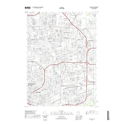
2019 Map of Buffalo NE
USGS Topo · Published 2019About this map
Theodore Roosevelt Inaugural National Historic Site serves as a prominent landmark in this urban landscape of Buffalo, highlighting the city's significant role in American political history. This 2019 survey captures the dense residential and institutional fabric of the northeast metropolitan area, extending through Kenmore, Amherst, and Williamsville. The map illustrates a concentration of religious and memorial history, particularly evident in the cluster of burial grounds such as the United German and French Cem, Saint Stanislaus Roman Catholic Cem, and the expansive Forest Lawn Cem. Educational centers are central to the region's character, including the State University of New York University at Buffalo and Canisius College. The natural drainage of Scajaquada Cr and Ellicott Creek provides a hydrological contrast to the grid-heavy neighborhoods of Snyder, Eggertsville, and Cheektowaga.
Find a feature on this map
51 named features on this map. Tap any name to fly to it.
Don’t see what you’re looking for? This feature index may not catch every label — zoom into the map to look around manually.
Map Details
Editions of this 2019 Buffalo NE Map
This is the sole edition of this map. No revisions or reprints were ever made.
Other maps of this area

1894 · Buffalo
USGS Topo · 1:62,500

1897 · Tonawanda
USGS Topo · 1:62,500

1897 · Lockport
USGS Topo · 1:62,500

1899 · Niagara
USGS Topo · 1:125,000

1900 · Tonawanda
USGS Topo · 1:62,500

1901 · Buffalo
USGS Topo · 1:62,500

1901 · Tonawanda
USGS Topo · 1:62,500

1902 · Lockport
USGS Topo · 1:62,500

1905 · Depew
USGS Topo · 1:62,500

1905 · Lockport
USGS Topo · 1:62,500