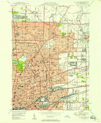
1948 Map of Buffalo NE
USGS Topo · Published 1958About this map
Buffalo and its northern suburbs are captured in high detail at a moment of significant post-war expansion. This landscape is a dense matrix of residential growth and industrial rail corridors, where the New York Central RR, Erie RR, and Lehigh Valley RR converge toward the city center. Large institutional footprints anchor the area, including the sprawling University of Buffalo campus and the historic grounds of Forest Lawn Cemetery. The map reveals a community defined by its neighborhoods, from the established streets of Kenmore and Williamsville to the developing tracts of Cleveland Hill. Notable civic landmarks such as Offerman Stadium, Canisius College, and the Buffalo Zoological Garden stand alongside a vast network of neighborhood schools and cemeteries, reflecting the social and cultural infrastructure of Erie County during the late 1940s.
Find a feature on this map
136 named features on this map. Tap any name to fly to it.
Don’t see what you’re looking for? This feature index may not catch every label — zoom into the map to look around manually.
Map Details
Editions of this 1948 Buffalo NE Map
This is the sole edition of this map. No revisions or reprints were ever made.
Other maps of this area

1894 · Buffalo
USGS Topo · 1:62,500

1897 · Tonawanda
USGS Topo · 1:62,500

1897 · Lockport
USGS Topo · 1:62,500

1899 · Niagara
USGS Topo · 1:125,000

1900 · Tonawanda
USGS Topo · 1:62,500

1901 · Buffalo
USGS Topo · 1:62,500

1901 · Tonawanda
USGS Topo · 1:62,500

1902 · Lockport
USGS Topo · 1:62,500

1905 · Depew
USGS Topo · 1:62,500

1905 · Lockport
USGS Topo · 1:62,500