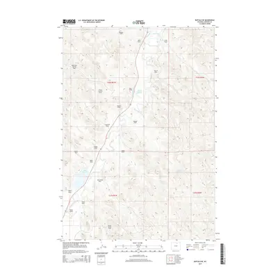
2015 Map of Buffalo NE
USGS Topo · Published 2015About this map
Clear Creek carves a winding path through the heart of this Johnson County landscape, serving as the central axis for an extensive network of ephemeral drainages and irrigation infrastructure. The territory is defined by its water management systems, notably the Big-Bonanza Ditch and Des-Molines Ditch, which redirect local flows to support a series of upland water bodies including Healy Reservoir and Four H Reservoir. These engineered features illustrate the intensive ranching and agricultural adaptations required in the semi-arid Powder River Basin.
Find a feature on this map
31 named features on this map. Tap any name to fly to it.
Don’t see what you’re looking for? This feature index may not catch every label — zoom into the map to look around manually.
Map Details
Editions of this 2015 Buffalo NE Map
This is the sole edition of this map. No revisions or reprints were ever made.
Other maps of this area

1900 · Fort McKinney
USGS Topo · 1:125,000

1903 · Fort McKinney
USGS Topo · 1:125,000

1909 · Sheridan
USGS Topo · 1:125,000

1911 · Sheridan
USGS Topo · 1:125,000

1955 · Sheridan
USGS Topo · 1:250,000

1958 · Sheridan
USGS Topo · 1:250,000

1962 · Sheridan
USGS Topo · 1:250,000
1970 · Buffalo
USGS Topo · 1:24,000

1970 · Buffalo NE
USGS Topo · 1:24,000
1970 · Horse Hill
USGS Topo · 1:24,000