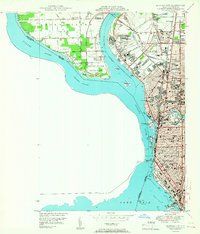
1950 Map of Buffalo NW
USGS Topo · Published 1950About this map
The Niagara River separates the industrial corridor of Buffalo and Tonawanda from the developing landscape of Grand Island during the post-war era. This survey, compiled from 1942 aerial photography and 1948 ground methods, illustrates the dense urban expansion through Kenmore and the northern reaches of Buffalo, where numerous public schools and institutional landmarks like the State Teachers College and State Hospital appear alongside a complex network of roads including Sheridan Drive.
Find a feature on this map
71 named features on this map. Tap any name to fly to it.
Don’t see what you’re looking for? This feature index may not catch every label — zoom into the map to look around manually.
Map Details
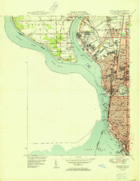
Editions of this 1950 Buffalo NW Map
2 editions found
Other maps of this area

1894 · Buffalo
USGS Topo · 1:62,500

1894 · Niagara Falls
USGS Topo · 1:62,500

1896 · Niagara Falls
USGS Topo · 1:62,500

1897 · Tonawanda
USGS Topo · 1:62,500

1899 · Niagara
USGS Topo · 1:125,000

1900 · Tonawanda
USGS Topo · 1:62,500

1900 · Niagara Falls
USGS Topo · 1:62,500

1901 · Buffalo
USGS Topo · 1:62,500

1901 · Niagara Falls
USGS Topo · 1:62,500

1901 · Tonawanda
USGS Topo · 1:62,500