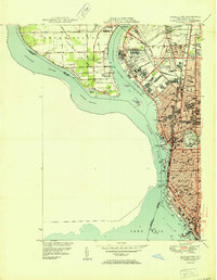
1950 Map of Buffalo NW
USGS Topo · Published 1950About this map
Grand Island occupies the northwestern portion of this 1950s survey, showing a landscape defined by its riparian edges and the developing Grandyle community. The southern tip of the island is dedicated to Beaver Island State Park, while the eastern shore across the Niagara River-Tonawanda Channel reveals the industrial and residential core of Tonawanda and Kenmore. The dense urban fabric of northern Buffalo is visible, characterized by a prolific network of educational institutions like State Teachers College and Lafayette High Sch.
Find a feature on this map
78 named features on this map. Tap any name to fly to it.
Don’t see what you’re looking for? This feature index may not catch every label — zoom into the map to look around manually.
Map Details
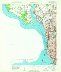
Editions of this 1950 Buffalo NW Map
2 editions found
Other maps of this area

1894 · Buffalo
USGS Topo · 1:62,500

1894 · Niagara Falls
USGS Topo · 1:62,500

1896 · Niagara Falls
USGS Topo · 1:62,500

1897 · Tonawanda
USGS Topo · 1:62,500

1899 · Niagara
USGS Topo · 1:125,000

1900 · Tonawanda
USGS Topo · 1:62,500

1900 · Niagara Falls
USGS Topo · 1:62,500

1901 · Buffalo
USGS Topo · 1:62,500

1901 · Niagara Falls
USGS Topo · 1:62,500

1901 · Tonawanda
USGS Topo · 1:62,500