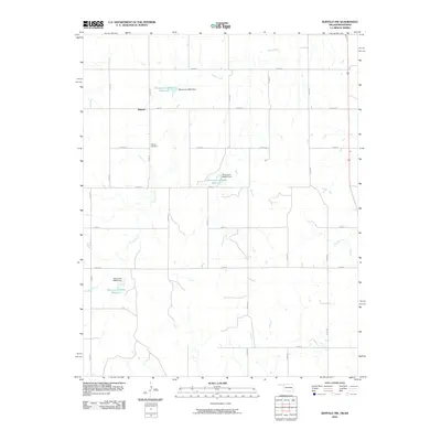
2010 Map of Buffalo NW
USGS Topo · Published 2010About this map
Willard sits at the heart of this high-plains landscape in Harper County, where the regular grid of section roads meets the winding path of Snake Creek. This 2010 survey illustrates a region defined by agricultural water management, evidenced by several small-scale reservoirs and dams like Oknoname 05907 Reservoir and Oknoname 059040 Reservoir. The settlement of Willard appears as a small node of activity, anchored geographically and historically by the nearby Willard Cemetery.
Find a feature on this map
25 named features on this map. Tap any name to fly to it.
Don’t see what you’re looking for? This feature index may not catch every label — zoom into the map to look around manually.
Map Details
Editions of this 2010 Buffalo NW Map
This is the sole edition of this map. No revisions or reprints were ever made.
Other maps of this area

1894 · Sitka
USGS Topo · 1:62,500

1896 · Ashland
USGS Topo · 1:125,000

1955 · Woodward
USGS Topo · 1:250,000

1955 · Pratt
USGS Topo · 1:250,000

1958 · Woodward
USGS Topo · 1:250,000

1959 · Pratt
USGS Topo · 1:250,000

1970 · Buffalo SE
USGS Topo · 1:24,000

1970 · Buffalo NW
USGS Topo · 1:24,000

1970 · Rosston NE
USGS Topo · 1:24,000

1970 · Buffalo NE
USGS Topo · 1:24,000