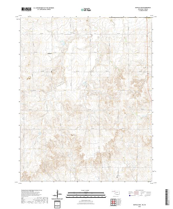
2022 Map of Buffalo NW
USGS Topo · Published 2022About this map
Willard stands at the intersection of a vast grid of section-line roads in northwestern Harper County, where the terrain begins to ripple with the drainages of the eastern panhandle. This rural landscape is defined by its water management, evidenced by several catchments including 05907 Reservoir, 059040 Reservoir, and 05905 Reservoir. These man-made features support agriculture in an area where Willow Creek provides one of the few natural drainage paths. Local history and genealogy are anchored here by the presence of Willard Cemetery and Otter Creek Cemetery, which serve as quiet markers of the families who settled this high plains region. The road network, meticulously labeled from E0020 Road to Ew 9, illustrates the enduring Public Land Survey System that carved this territory into distinct townships such as t29n r23w.
Find a feature on this map
25 named features on this map. Tap any name to fly to it.
Don’t see what you’re looking for? This feature index may not catch every label — zoom into the map to look around manually.
Map Details
Editions of this 2022 Buffalo NW Map
This is the sole edition of this map. No revisions or reprints were ever made.
Other maps of this area

1894 · Sitka
USGS Topo · 1:62,500

1896 · Ashland
USGS Topo · 1:125,000

1955 · Woodward
USGS Topo · 1:250,000

1955 · Pratt
USGS Topo · 1:250,000

1958 · Woodward
USGS Topo · 1:250,000

1959 · Pratt
USGS Topo · 1:250,000

1970 · Buffalo SE
USGS Topo · 1:24,000

1970 · Buffalo NW
USGS Topo · 1:24,000

1970 · Rosston NE
USGS Topo · 1:24,000

1970 · Buffalo NE
USGS Topo · 1:24,000