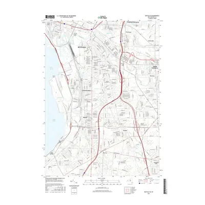
2016 Map of Buffalo SE
USGS Topo · Published 2016About this map
Industrial waterways and dense neighborhood grids define this 2016 view of the southern approach to Buffalo. The confluence of Buffalo River, Buffalo Creek, and Cayuga Creek highlights the historic importance of the region's river network, while modern infrastructure like the Aurora Expwy and Southside Pkwy cuts through established residential blocks. This survey reveals the transition from the heavy industrial shoreline at Stony Point and the South Entrance Channel to the suburban expansion of West Seneca and Orchard Park.
Find a feature on this map
40 named features on this map. Tap any name to fly to it.
Don’t see what you’re looking for? This feature index may not catch every label — zoom into the map to look around manually.
Map Details
Editions of this 2016 Buffalo SE Map
This is the sole edition of this map. No revisions or reprints were ever made.
Other maps of this area

1894 · Buffalo
USGS Topo · 1:62,500

1901 · Buffalo
USGS Topo · 1:62,500

1905 · Depew
USGS Topo · 1:62,500

1905 · Eden
USGS Topo · 1:62,500

1907 · Eden
USGS Topo · 1:62,500

1925 · Springville
USGS Topo · 1:62,500

1944 · Eden
USGS Topo · 1:62,500

1944 · Hamburg
USGS Topo · 1:31,680

1948 · Hamburg
USGS Topo · 1:24,000

1948 · Depew
USGS Topo · 1:62,500