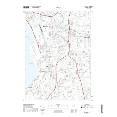
2019 Map of Buffalo SE
USGS Topo · Published 2019About this map
Industrial corridors and suburban expansion define this 2019 survey of the area southeast of Buffalo. The landscape is intricately partitioned by heavy rail lines including Norfolk Southern and CSX Transportation, which trace the historic manufacturing heart of Lackawanna and Blasdell. Near the shore of Lake Erie, Stony Point and the Lake Approach Channel indicate the region's enduring maritime importance. Inward from the lake, several institutional campuses such as Trocaire College and Hilbert College are established among dense residential neighborhoods.
Find a feature on this map
47 named features on this map. Tap any name to fly to it.
Don’t see what you’re looking for? This feature index may not catch every label — zoom into the map to look around manually.
Map Details
Editions of this 2019 Buffalo SE Map
This is the sole edition of this map. No revisions or reprints were ever made.
Other maps of this area

1894 · Buffalo
USGS Topo · 1:62,500

1901 · Buffalo
USGS Topo · 1:62,500

1905 · Depew
USGS Topo · 1:62,500

1905 · Eden
USGS Topo · 1:62,500

1907 · Eden
USGS Topo · 1:62,500

1925 · Springville
USGS Topo · 1:62,500

1944 · Eden
USGS Topo · 1:62,500

1944 · Hamburg
USGS Topo · 1:31,680

1948 · Hamburg
USGS Topo · 1:24,000

1948 · Depew
USGS Topo · 1:62,500