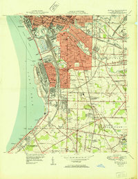
1950 Map of Buffalo SE
USGS Topo · Published 1950About this map
Lake Erie defines the western edge of this post-war landscape, where the heavy industrial waterfront of Lackawanna and Buffalo meets the growing suburban reach of West Seneca and Orchard Park. The shoreline is a hub of maritime and rail activity, anchored by the South Buffalo Lighthouse at Stony Point and the sprawling rail yards of the Pennsylvania RR and New York Central RR. Inland, the map reveals a dense network of civic life, from the landmark Basilica Of Our Lady Of Victory to numerous local institutions like McKinley Sch and St Johns Cem. The era of modern transportation is emerging, evidenced by the early path of the New York State Thruway cutting through the landscape. This survey provides a look at the transition from the concentrated urban core to established outlying settlements like Gardenville, Ebenezer, and Blasdell.
Find a feature on this map
76 named features on this map. Tap any name to fly to it.
Don’t see what you’re looking for? This feature index may not catch every label — zoom into the map to look around manually.
Map Details
Editions of this 1950 Buffalo SE Map
This is the sole edition of this map. No revisions or reprints were ever made.
Other maps of this area

1894 · Buffalo
USGS Topo · 1:62,500

1901 · Buffalo
USGS Topo · 1:62,500

1905 · Depew
USGS Topo · 1:62,500

1905 · Eden
USGS Topo · 1:62,500

1907 · Eden
USGS Topo · 1:62,500

1925 · Springville
USGS Topo · 1:62,500

1944 · Eden
USGS Topo · 1:62,500

1944 · Hamburg
USGS Topo · 1:31,680

1948 · Hamburg
USGS Topo · 1:24,000

1948 · Depew
USGS Topo · 1:62,500