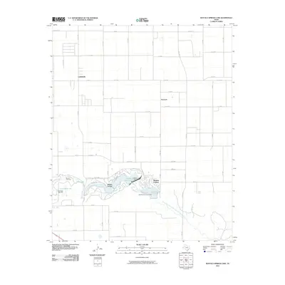
2010 Map of Buffalo Springs Lake
USGS Topo · Published 2010About this map
Buffalo Springs and Ransom Canyon anchor this portion of the Texas South Plains, where the North Fork Double Mountain Fork Brazos River cuts a significant topographical break into the surrounding agricultural grid. This waterway is managed through a series of water control structures including the McMillan Dam and Lake Ransom Canyon Dam, which create recreational and residential reservoirs like Buffalo Springs Lake and Lake Ransom Canyon. Outside the immediate canyon environments, the landscape is defined by a rigorous section-line road network, including Acuff Rd and Posey Rd, servicing small clusters such as Roosevelt and the locality of Canyon. Small private water bodies like Arnett Lake and Clear Water Lake dot the area west of the primary canyon system, illustrating the importance of water management in this arid Lubbock County landscape.
Find a feature on this map
55 named features on this map. Tap any name to fly to it.
Don’t see what you’re looking for? This feature index may not catch every label — zoom into the map to look around manually.
Map Details
Editions of this 2010 Buffalo Springs Lake Map
This is the sole edition of this map. No revisions or reprints were ever made.
Other maps of this area

1954 · Lubbock
USGS Topo · 1:250,000

1956 · New Deal
USGS Topo · 1:24,000

1957 · Lubbock East
USGS Topo · 1:24,000

1957 · New Home
USGS Topo · 1:62,500

1957 · Lubbock
USGS Topo · 1:62,500

1965 · Acuff
USGS Topo · 1:24,000

1965 · Slaton
USGS Topo · 1:24,000

1965 · Buffalo Springs Lake
USGS Topo · 1:24,000

1965 · Slaton NE
USGS Topo · 1:24,000

1965 · Idalou
USGS Topo · 1:24,000